Auckland Airport (AKL)
Orientation and Maps
(Auckland, New Zealand)
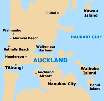
One of the most important cities on New Zealand's North Island, Auckland has become the country's most prominent international gateway. Close to Auckland, Westfield, Papakura, Tuakau, Huntly, Ngaruawahia, Hamilton and Cambridge all lie to the south, together with Auckland International Airport (AKL).
The main area of commerce in the centre of Auckland is based around Queen Street, which stretches between Karangahape Road to Britomart Station, close to the waterfront area, passing the Skytower and also Aotea Square along the way.
Auckland International Airport (AKL) Maps: Important City Districts
The centre of Auckland is known for its high concentration of places to eat, together with its large number of popular nightspots and hotels. However, K Road is a particularly lively part of Auckland and rivals the city centre, with its ethnic eateries, bars and trendy clubs.
Located on the eastern side of central Auckland, Parnell Road is home to numerous stylish wooden villas, many of which have been successfully converted into stylish restaurants. This busy road leads to the Newmarket area of Auckland, where fashion boutiques are particularly plentiful.
Important suburbs on the outskirts of Auckland include Mission Bay, Mount Eden and Takapuna, all of which are worth visiting and contain a range of local shops and dining venues. The enticing waterside suburb of Devonport is an extremely appealing location and can be reached be regular ferries. Beach activities, water sports and bush walking are all popular in this area.
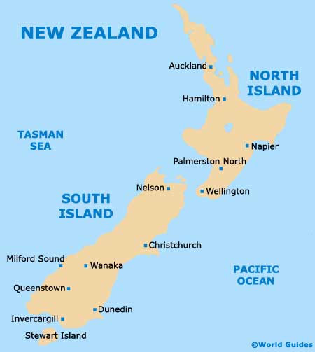
New Zealand Map
Auckland Map