Auckland Airport (AKL)
Driving Directions / Travel by Car
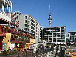
(Auckland, North Island, New Zealand NZ)
Located directly south of Auckland city centre, the airport can be reached in roughly 30 minutes, being close to Mangere South and Ihumatao. Auckland Airport (AKL) is sited to the west of Manukau City, Papatoetoe East and Puhinui.
Near to Auckland Airport, the Southern Motorway leads southwards from the very heart of the city and along the way passes Grafton, Mount Eden North, Remuera, Penrose, Ellerslie South, Southdown, Westfield, Mount Wellington South and Otahuhu. The Southern Motorway becomes the Auckland Hamilton Motorway as it passes Otara and East Tamaki.
On the outskirts of Auckland Airport, both Tom Pearce Drive (off Wyllie Road and Puhinui Road) and George Bolt Memorial Drive (off Kirkbride Road, Massey Road and Bader Drive) connect the complex with nearby motorways.
Directions to Auckland Airport (AKL) from Auckland city centre:
- Auckland Airport stands around 20 km / 12.5 miles to the south of the city centre
- Major roads that travel to and from Auckland Airport include George Bolt Memorial Drive and also the Southern Motorway, where you will need to turn off at the Gillies Avenue junction
- The South Western Motorway also links the airport to the south of central Auckland, from the Hugh Watt Drive in the Royal Oak area, close to Greenwoods Corner and Onehunga South
Auckland Airport (AKL): Virtual Google Maps
